Taking the Guesswork Out of Freeway Driving
- Share via
For Gail Dearing, driving in Los Angeles is often a crapshoot.
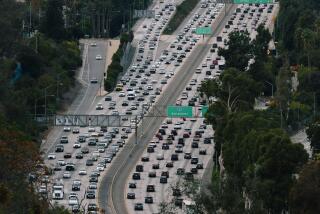
From her Eagle Rock home, the health care writer can breeze to a meeting in West Los Angeles with few delays, or she can get caught in nightmarish baseball traffic near Dodger Stadium that sends her commute into extra innings.
“My drive is different every day, so I don’t know what it will be like,” she said.
What Dearing--and the rest of Southern California--could use is a reliable traffic forecast that estimates freeway travel times, thus letting drivers make informed decisions on what time to start a trip and what routes to take.
The idea is not so farfetched.
Some simple traffic forecast systems are already operating in several cities, including Atlanta, Houston, San Antonio, Seattle and Washington, D.C. Most of these systems let motorists use a computer or telephone to get a travel-time estimate on a handful of predetermined routes. The estimates are based on traffic conditions collected from electronic sensors in the freeway pavement.
Some systems are more advanced than others.
In San Antonio, motorists can log onto an Internet system known as Transguide, which lets drivers draw a route on a freeway map with a few mouse clicks. The program then calculates the travel time between the starting and ending points, assuming traffic conditions remain stable.
In Philadelphia, customers of Trafficpulse.com can get drive-time estimates over the phone. Customers can simply say the name of the freeway and the starting and ending points for the drive. A voice recognition system converts the words into computer data, which is used to calculate the travel time.
So where is the high-tech traffic prognosticator for Southern California, the nation’s mecca for traffic headaches? Answer: It’s held up in a legal squabble.
Traffic engineers at UC Berkeley have worked for four years designing a traffic monitoring system for California. The performance evaluation monitoring system, known as PEMS, not only would use current conditions to estimate travel times, but also incorporate historical freeway data from the previous six months. Think of it as the Weather Channel for commuters.
Motorists in Southern California and in many major cities throughout the country already can check traffic conditions on Internet maps that show real-time freeway speeds represented with green for fast, yellow for slow and red for snail’s pace. But PEMS would be much more advanced because it would offer precise time estimates for individual routes. With real-time maps, motorists can only guess the drive time based on a bunch of colored lines.
In addition, PEMS would know--based on historical data--that Monday morning traffic on the Pasadena Freeway is usually light, while a Friday afternoon around Los Angeles International Airport is a traffic quagmire.
Transportation experts say PEMS would be the most advanced traffic monitoring system in the nation. That is, of course, assuming it is put into operation.
The system was scheduled to go online next month in Southern California, Sacramento and the Bay Area. But it has been put on hold because of a legal dispute over who owns the intellectual rights to a mathematical equation used in the program. The dispute is among some of the Berkeley engineers who designed the system.
Officials at the California Department of Transportation promise to launch the system and make it available to the public just as soon as the dispute is settled, which, they say, could be a few weeks or a few months.
Once PEMS is launched, travel times along common commuting routes would appear on the Caltrans Web site and perhaps on those changeable message signs installed along the shoulders of most freeways.
How would that help you?
You are driving on the Golden State Freeway from Santa Clarita to work in downtown Los Angeles, and the drive-time estimate on the lighted sign overhead says you are going to be late again. Thanks to the computerized system, you can try to find a faster route to work or start thinking of a good excuse for when you arrive.
Certainly, traffic forecasting systems don’t make traffic magically disappear. Still, traffic experts say the systems can help motorists make more informed driving decisions. Many motorists have plenty of leeway on what time to leave and what route to take. Only 20% of car trips in Southern California are taken to and from work. A much bigger chunk of traffic is generated by trips to the market, post office, soccer practice and other errands.
“It allows travelers to make choices they may not otherwise make,” said Brian Taylor, director of UCLA’s Institute of Transportation Studies. “It makes us wring more productivity out of the system.”
Here is another example of how the system can help: You are ready to leave work in downtown Los Angeles at 6 p.m., and the traffic forecast system predicts your drive home to Woodland Hills will take 60 minutes. But the system also predicts--based upon historical data--that if you wait until 6:30 p.m., your drive will take only 40 minutes.
“You can then decide whether to stay at work and drink another cup of coffee,” said Pravin Varaiya, the UC Berkeley professor who developed the system for Caltrans.
Such travel-time estimates would be especially helpful for motorists who are unfamiliar with the region and don’t know, for example, that the Santa Monica Freeway near the San Diego Freeway turns into a vehicular mosh pit every day about 5 p.m.
Travel-time estimates would also be helpful to someone who is in the market for a new home. Before going into escrow, a potential home buyer could get an estimate on the daily commute and decide whether that extra large backyard is really worth a 90-minute drive to work each day.
“The potential is enormous,” Taylor said.
These systems have one great weakness: There is no way to predict freeway accidents, which are responsible for nearly half of all traffic congestion in Southern California.
“That is really the difficulty in predicting traffic,” said Matt Beaulieu, a transportation engineer who helps operate the traffic monitoring system for the Washington Department of Transportation. “There is just so much randomness.”
Varaiya said the monitoring system created for California would recalculate traffic estimates every five minutes based on new freeway data. If an accident suddenly turns a relatively easy freeway commute into the road to perdition, the system can alert motorists quickly, he said.
“If an incident happens, it changes the speeds very rapidly, and current conditions are no longer the same,” he said.
Most of these systems calculate travel times only on freeways because that is where the pavement sensors are. But transportation experts say the ultimate goal is to create a system that can make estimates from your garage to the doorstep of your destination.
Dearing, the writer from Echo Park, said she likes the idea of a traffic forecast system but foresees one small glitch: “Would I remember to check the forecast before I go? I don’t know.”
*
If you have a gripe, question or story idea about driving in Southern California, send an e-mail to behindthewheel@ latimes.com.
More to Read
Sign up for Essential California
The most important California stories and recommendations in your inbox every morning.
You may occasionally receive promotional content from the Los Angeles Times.


